Activities
Coastal Hazards - Achievements
- As part of the tsunami inundation modelling and mapping project, Tunami-N2 numerical models were run for various scenarios and tsunami hazard maps on 1:25000 scale based on CartoSat elevation data was generated for all coastal states of India. Large Scale tsunami hazard maps (1:5000) using ALTM data was generated for coastal Tamil Nadu.
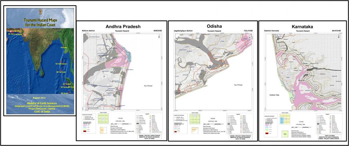
Tsunami Hazard Maps(East Coast of India)
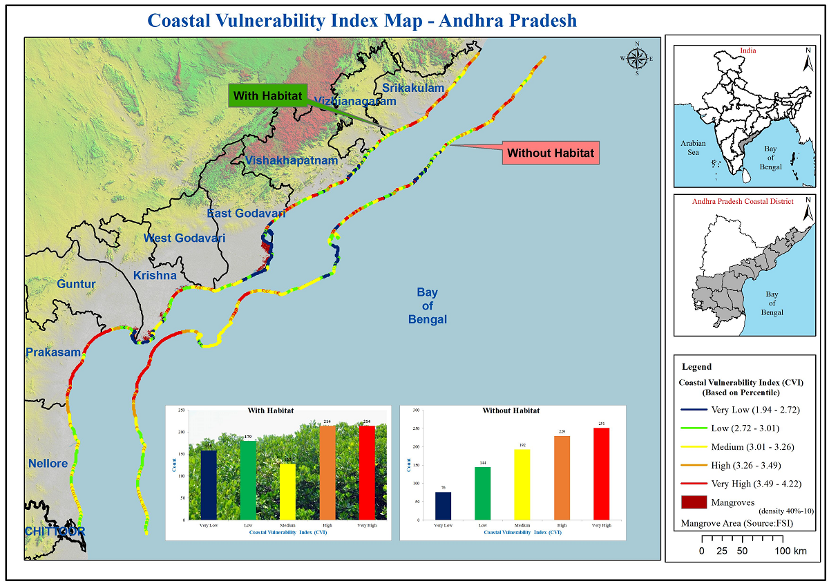
- An integrated approach coupling geospatial tools, field survey and InVest models (CVA and HRA) was used to assess the biophysical vulnerability of three coastal states namely Andhra Pradesh, Odhisa and Maharashtra.
- Chennai Flood Warning System was developed as a multi institutional project initiated by Office of Principal Scientific Advisor involving IIT-Bombay, IIT- Chennai, IRS-Anna University, IISC Bangalore and MoES Institutes NCCR, IMD, NCMRWF, INCOIS, Govt of Tamil Nadu. A webGIS based operational Chennai Flood Warning System (C_FLOWS) was built in-house and is being made available to the State Government through their TN-SMART portal. Mirror units of C-FLOWS will be placed in the office of the Commissioner of Revenue Administration (CRA), Greater Chennai Corporation, Govt of Tamil Nadu and IMD, as per the decision taken by Ministry of Earth Sciences and Principal Scientific Advisor.

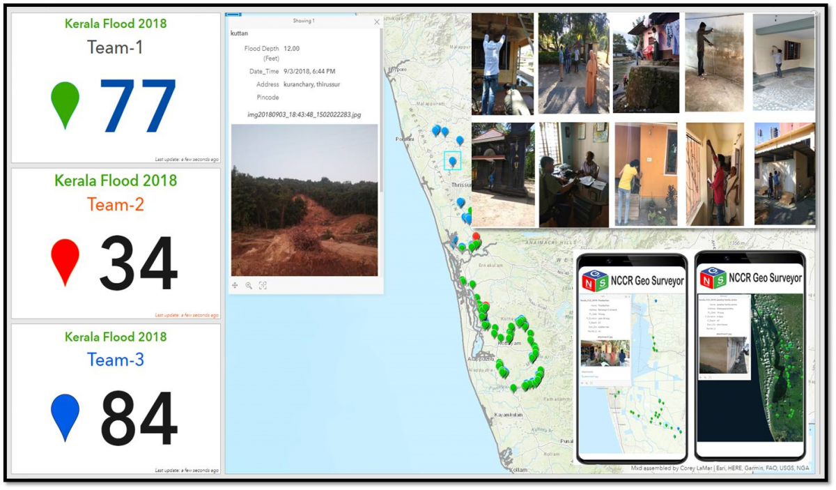
- Mapping of foot prints left behind by the Kerala Floods and Gaja Cylcone was carried out using mobile app NCCR-GEO SURVEYOR, built in-house for field data collection
- A MoU was signed between NCCR, IMD and Dept of Fisheries, Govt. of Tamil Nadu to develop a WebGIS based decision support system and mobile based app (Thoondil) for the safety and security of fishermen specially during hazard times. Weather and PFZ information from IMD and INCOIS are also made available to the fishermen through this app.
- The dashboard is for the state administrators to get an overview of the fishing operations in the state while the app is mobile based with many features such as weather, PFZ, compass, rescue routes, SoS etc which would be of immense use to the fishermen.
